
Mount Baker-Snoqualmie National Forest - Alternative Transportation Feasibility Study
Mount Baker-Snoqualmie National Forest (MBSNF) is located in close proximity to the Puget Sound metropolitan area in western Washington State. The forest is facing a number of transportation issues, such as increasing congestion and decreasing availability of parking, which may negatively impact resources and visitors. In 2007, an interagency transportation assistance group (TAG) visit was conducted at MBSNF, resulting in recommendations for next steps. In 2008, MBSNF submitted and received a Federal Transit Administration (FTA) Paul S. Sarbanes Transit in Parks planning grant to examine these issues by conducting an alternative transportation study. Alternative transportation encompasses a broad array of modes and strategies, including pedestrian, bicycle, transit, and supporting information technology, that aim to provide alternatives to single-occupancy vehicles.
The study is intended to assess transportation issues, and evaluate solutions for those issues, on and along the four major highway corridors through the MBSNF: State Route (SR) 542, U.S. Route 2 (US-2), Interstate 90 (I-90), and SR 410. All of these four corridors offer winter and summer recreational opportunities and provide direct access to a specific ski area.
Due to the study's large regional scope and multi-modal approach, the limited availability of funding, and the desire to lead to specific implementation projects, the forest, working with the Western Federal Lands Highway Division (WFLHD), determined the study would be divided into two phases. Phase I was the scoping phase and was intended to identify how the remainder of the funding could be best used, given the multiple corridors and issues and limited resources. Its approach and findings are described below. Phase II further narrowed the focus down to the I-90 corridor and built on the recommendations from Phase I to discuss a range of transportation options.
Background Documents
Phase I
Phase I consisted of goal identification, data assessment, stakeholder meetings, and development of a statement of work for Phase II based on corridor and strategy prioritization.
Phase I began in May 2011 and was completed in May 2012.
- Executive Summary
- Phase I Final Report
- Corridor Information Sheets
Phase II
Phase II consisted of stakeholder outreach, data collection, and analysis that led to a transit feasibility assessment for I-90 and a traveler information assessment for the entire forest.
Phase II Final Report, April 2014:
Mount Baker – Snoqualmie National Forest Alternative Transportation Feasibility Study Phase II: Final Report
Traveler Information
The project team delivered a system that turns the forest’s existing web page with text-based road and trail status updates into a dynamically updated map. The team also provided recommendations for new trip planning maps and an app, updated visitor information pages, and integration with WSDOT traveler information systems.
Transit
The Phase II report proposes a phased roll-out of bus transit service to make it easy to reach and travel around the forest without a car. This transit system would begin by expanding existing winter shuttle services, then scaling up to a new summer circulator service. Full implementation would connect forest destinations to nearby communities and Seattle year-round.
Current conditions are unfavorable for transit due to the essentially unlimited amount of unofficial parking available in established recreation areas. Because of this, the most feasible new services to pursue in the near future are expanding existing winter service, working to improve rental vans and buses for youth groups and non-profits, and introducing transit to new forest corridors, especially the Middle Fork.
Phase III
The Phase III report focuses on parking management in the forest along the I-90 corridor. It is a focused follow-on to Phase II, which identified the unlimited supply of overflow parking along road shoulders as a major disincentive for visitors to take transit. The Phase III report describes existing parking enforcement and design at the forest, and describes changes that would limit parking to designated parking areas. These policy changes would have a variety of environmental, fiscal, and transportation impacts to the forest and its visitors which are detailed in the report.
Phase III Final Report, April 2015:
Mount Baker – Snoqualmie National Forest Denny Creek Area Parking Impact Assessment: Final Report
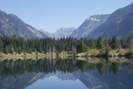
Mount Baker-Snoqualmie National Forest (Volpe photo)